
Quick verdict
Propeller Aero Review 2026: Drone Surveys and DirtMate Turn Earthwork Into a Shared 3D Map
Updated October 29, 2026 – Tested Intelligence
Quick verdict: Propeller Aero turns drone flights into survey-grade 3D site maps that earthwork and civil teams use to measure cut and fill, prove progress and settle quantity disputes with a shared record. It is built for open, outdoor sites and frequent flying. If your work is interiors, vertical buildings or a survey once a year, the cost and workflow will be hard to justify.
What it is
Propeller Aero is a cloud platform for drone surveying on construction, mining, aggregates and waste sites. You fly a drone over the site, Propeller processes the imagery into a 3D map, and anyone on the team can measure volumes, compare surfaces against design, and check what has changed since the last flight – from a browser, not a surveyor’s laptop.
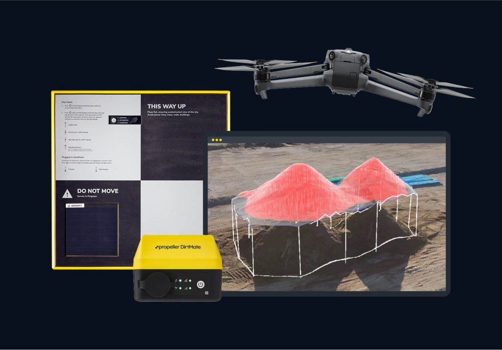
Two pieces of Propeller’s own hardware feed it. AeroPoints are smart ground control points with built-in GNSS that give each flight survey-grade accuracy. DirtMate is a machine-mounted GNSS receiver that streams position and utilization data from earthmoving equipment, updating surfaces between flights. Propeller’s customer stories show the pattern: Haskell catching a mislocated conduit in a twice-weekly survey review before it collided with new pipework.
Key features
- Cloud 3D mapping: drone photogrammetry and LiDAR processing with drag-and-drop upload
- Volumes and progress: cut/fill, stockpile volumes, remaining quantities and surface-to-design comparisons
- AeroPoints: smart ground control points, rated by Propeller at 10mm + 1ppm horizontal accuracy
- DirtMate: machine-mounted GNSS with cut-fill heatmaps, cycle counts and daily utilization metrics
- Propeller PPK: integrated processing workflow for survey-grade results from supported drones
- Integrations: Trimble Connect, Procore, Autodesk BIM 360 and Build, Aconex, OneDrive and HCSS
- Shared access: unlimited-user style team viewing, reporting templates and a visual site history
Pricing
Pricing is not public. Propeller does not publish subscription prices on its site; you request a demo and get a quote. Trade coverage from IRONPROS describes how the packages work in practice – subscriptions scaled by survey volume, packages that include unlimited users and sites, and an enterprise tier described at around $12,000 per year for a single drone – but treat those figures as trade-sourced and to-verify with Propeller, not as a price list. AeroPoints and DirtMate hardware are extra, and IRONPROS notes AeroPoints-only service at $600 per year. Budget for the drone itself on top.
Who it’s for
Earthwork, sitework, heavy civil and aggregate operations that fly weekly or more: GCs proving progress for billing, excavation contractors tracking cut/fill against design, and quarry managers watching stockpiles. If one quantity dispute costs you five figures, a shared timestamped record pays for itself.
Who should skip it
Vertical builders, interior fit-out crews and anyone whose site fits in one photo should skip it – this is open-air earthwork tooling. Small contractors who survey a site once or twice a year will get the same answer cheaper from a surveyor on call. And you still need someone who can fly legally and consistently; Propeller processes data, it does not fly the drone for you.
Pros
- One shared map ends most “how much dirt moved” arguments with a timestamped record
- AeroPoints remove most of the ground-control pain that makes drone surveys slow
- DirtMate fills the gap between flights with live machine data instead of stale surfaces
- Processing is handled in the cloud – no photogrammetry workstation or specialist software
- Integrates with the Trimble, Procore and Autodesk tools civil teams already run
Cons
- No published pricing – every deal is a quote, so budgeting takes a sales process
- Hardware (AeroPoints, DirtMate, the drone) is on top of the subscription
- Value depends on flying often; infrequent users subsidize a workflow they do not use
- Outdoor earthwork focus – little here for vertical or interior construction
FAQ
Does Propeller work with any drone?
Propeller says it supports all drones, including non-PPK models with a GPS-enabled camera, though PPK delivers the highest accuracy.
How accurate is it?
Propeller rates AeroPoints at 10mm + 1ppm horizontal and 20mm + 1ppm vertical. Real-world accuracy still depends on flight setup, control placement and site conditions – it is survey-grade workflow, not a substitute for a licensed surveyor where one is legally required.
What does Propeller cost?
Pricing is not public and is quote-based. IRONPROS reports packages scaling with survey volume, with an enterprise single-drone tier around $12,000 per year; confirm current figures directly with Propeller.
Bottom line
For earthwork and civil teams, Propeller Aero is the shared source of truth for what the site actually looks like today – measured, timestamped and hard to argue with. Get a quote if you fly weekly and quantities drive your billing. Skip it if your sites are small, indoor or rarely surveyed.