
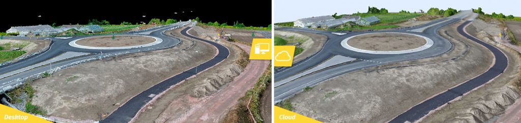
Pix4D Review 2026: Survey-Grade Photogrammetry From Drone and Phone Imagery
Updated November 13, 2026 – Tested Intelligence
Quick verdict: Pix4D is a family of photogrammetry products – PIX4Dmatic on the desktop, PIX4Dcloud in the browser and PIX4Dcatch on a phone – that turns drone, mobile and LiDAR imagery into measurable orthomosaics, point clouds, meshes and CAD-ready vectors for construction documentation and earthwork. It is the precision-first alternative to DroneDeploy’s all-in-one cloud. The detail buyers miss is on Pix4D’s own pricing page: the cheapest PIX4Dmatic plan, Analyst at $2,290 a year, does not include an orthomosaic, mesh or DSM at all – that output starts at Standard, $3,990 a year.
What it is
Pix4D is a Swiss photogrammetry company, spun out of EPFL in 2011, that sells processing software rather than drones or a capture service. You fly or walk the site with whatever hardware you already own – Pix4D is drone-agnostic and also takes terrestrial photos and LiDAR – and Pix4D’s software reconstructs a measurable model of what is actually there: an orthophoto you can measure from, a dense point cloud, a surface model and extracted vectors a CAD team can use.
On a construction job that means dated, measurable records instead of memory: earthwork and stockpile volumes, progress orthophotos laid over design, as-built surfaces checked against grade, and a shareable cloud timeline in PIX4Dcloud that an owner or a remote engineer can open in a browser. PIX4Dcatch covers the small end of the same job from a phone or tablet, including RTK-equipped capture for tighter accuracy.
What the pricing page does not make obvious is how the three PIX4Dmatic tiers divide the outputs, because the plan names do not say it. Pix4D’s own feature lists show Analyst built around terrain and CAD – calibration, point cloud, integrated CAD extraction, terrain classification, grid of points, TIN, DTM and contour lines – with no orthomosaic, mesh or DSM listed. Standard adds exactly those mapping outputs: mesh, DSM, orthomosaic and orthoplanes, plus drone, mobile and LiDAR data in one project. Pro then adds Gaussian Splatting and a unified end-to-end geospatial-plus-CAD workflow. A buyer who purchases Analyst expecting a site orthophoto has bought the wrong tier.
Key features
- Desktop photogrammetry in PIX4Dmatic: calibration and dense point clouds from large drone, mobile and LiDAR datasets, processed on your own Windows or Mac machine with no upload required
- Survey deliverables: DSM, DTM, TIN, contour lines, grid of points, surface comparison and georeferencing, with ground-control and checkpoint workflows for traceable accuracy
- CAD-ready extraction: integrated vectorization and CAD extraction, expanded on Pro with advanced detection and a unified geospatial and CAD data model
- PIX4Dcloud for sharing and progress: browser processing, measurement, timeline comparison and volume work on the same data, so owners and engineers see the site without desktop software
- PIX4Dcatch ground capture: phone and tablet scanning for trenches, interiors and detail areas a drone cannot reach, including RTK rover workflows
- Hardware freedom: imagery from any drone maker plus terrestrial and LiDAR sources in one project, instead of a single-vendor capture stack
Pricing
Pricing is published per product on Pix4D’s own pricing pages, excluding taxes. PIX4Dmatic is $2,290 a year for Analyst, $3,990 a year for Standard and $4,990 a year for Pro, billed yearly, each including free self-paced training; monthly and three-year terms are also offered at different effective rates. PIX4Dcloud is sold separately, listed in recent pricing coverage of Pix4D’s pages at $1,290 a year for Starter with 500 processing credits and $4,490 a year for Pro with 2,500 credits, with Enterprise quoted – verify the current credit bundle on the PIX4Dcloud page before budgeting, because cloud processing is metered in credits, unlike desktop processing. PIX4Dmapper, the older desktop flagship, was listed at $3,990 a year, and Pix4D is steering new buyers to PIX4Dmatic – confirm which product a quote actually names. A 15-day trial is available. There is no free tier.
Who it’s for
Surveyors, civil and earthwork contractors, and GCs who need measurements they can defend: volumes for pay quantities, surfaces checked against design, and dated site records for disputes and progress claims. It fits best when accuracy documentation matters more than one-click convenience, and when you want processing on your own machine and hardware you already own.
Who should skip it
Project teams who mainly want an easy, standardized site-documentation rhythm – fly, upload, share a progress timeline – will usually be happier in DroneDeploy, which Tested Intelligence has already reviewed as a single cloud platform built for that workflow, even though its entry plan runs about $4,188 a year. Small builders who fly a site twice a year should also skip Pix4D: at $3,990 a year for the tier that makes an orthomosaic, a per-flight service or a cheaper cloud plan is the honest math. And nobody should buy Analyst for mapping output – see the pricing note above.
Pros
- Survey-grade control: ground control, checkpoints and quality reporting that hold up when a measurement is challenged
- Desktop processing keeps imagery on your own machine – no mandatory cloud upload of a sensitive site
- Drone-agnostic: any aircraft, plus phone and LiDAR capture, in a single project
- One vendor covers both ends of the job, from PIX4Dcatch trench scans to city-scale PIX4Dmatic datasets
- Published per-product pricing, with training included on PIX4Dmatic plans
Cons
- The cheapest PIX4Dmatic tier cannot make an orthomosaic – Standard at $3,990 a year is the real mapping entry price
- It is a product family, not one app: desktop, cloud and catch licences and cloud credits are separate budget lines
- Cloud processing in PIX4Dcloud is credit-metered, so heavy months cost more than the subscription suggests
- No free tier – only a 15-day trial – and a capable workstation is part of the real desktop cost
- The older PIX4Dmapper line is being superseded by PIX4Dmatic, so older comparisons and quotes go stale quickly
FAQ
Which PIX4Dmatic plan do I need for an orthomosaic of my site?
Standard, at $3,990 a year billed yearly. Pix4D’s own pricing page lists mesh, DSM, orthomosaic and orthoplanes under Standard and Pro, not under the $2,290 Analyst plan, which is built for terrain and CAD extraction from point clouds instead.
Is Pix4D a replacement for DroneDeploy?
They overlap on drone mapping and split on philosophy. DroneDeploy is one cloud platform tuned for repeatable construction documentation and sharing. Pix4D is a processing suite tuned for survey control and deliverables, with desktop processing and hardware freedom. Pick by whether your bottleneck is collaboration or measurement defensibility.
Do I need a specific drone to use Pix4D?
No. Pix4D processes imagery from any drone, plus terrestrial photos, phone capture through PIX4Dcatch and LiDAR data, and can combine sources in one PIX4Dmatic project. Accuracy still depends on your capture: overlap, lighting and ground control decide the result more than the brand on the aircraft.
Bottom line
Pix4D is the photogrammetry suite to shortlist when the map has to be right, not just pretty: defensible volumes, checked surfaces and CAD-ready vectors from whatever you fly or carry. Budget it honestly – Standard, not Analyst, if you want orthophotos, PIX4Dcloud and its credits on top if the team needs to share in a browser – and it earns its place next to, not instead of, your project platform.